04 / GCS

Ground Control Station

The shore end, designed for one operator and several vessels — every vessel’s position and status on one map, with the selected vessel’s video, instruments and autonomy state alongside.
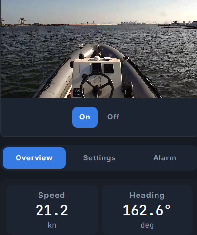
A detail of the shore station: the selected vessel’s live camera above two readings, speed 21.2 knots and heading 162.6 degrees
A detail of one frame of the shore station, recorded during a harbour sea trial in 2026. The reading is that instant, not a summary: the vessel is making 21.2 knots. The map, the fleet list and the mission panel are outside both crops on this page.
VideoLive video from the selected vessel, pulled on demand rather than held open — each vessel has its own stream.
TelemetryOur own telemetry protocol, over UDP. The browser receives it from the shore station over a websocket.
Manual controlA standard game controller. Layouts we have not measured are refused rather than guessed.
FleetDesigned for several vessels: each gets its own card — position, heading, speed, link and control mode.
DashboardSpeed, heading, engine state and link status.
AutonomyDispatch a mission and watch it come back: planned path, progress and cross-track error.
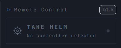
A second detail of the same screen: a remote-control panel marked Idle, with Take helm greyed out and the line No controller detected>
The same frame, lower down the screen: the station’s remote control is idle, with no controller connected to it — at the same moment the reading above has the vessel making way.
Shore station and vessels: video and telemetry come ashore, missions and control go out Shore station desktop app + local service fleet view · joystick video · telemetry · mission Vessel 1 autonomy stack Vessel 2 autonomy stack Vessel 3 autonomy stack
Missions go out to the vessel’s onboard autonomy stack; the planned path, progress and cross-track error come back. Designed for several vessels from one station — the photographs above are one vessel, which is all that has been at sea at a time.